
From filtering, drawing and search to API improvements, discover what’s new !
This summer, GeoGirafe got a series of improvements and introduced a number of new features and not just minor ones! GeoGirafe is always striving to provide the best possible user experience and exploring new ways to meet everyone’s needs.
Explore data in more detail with advanced filtering
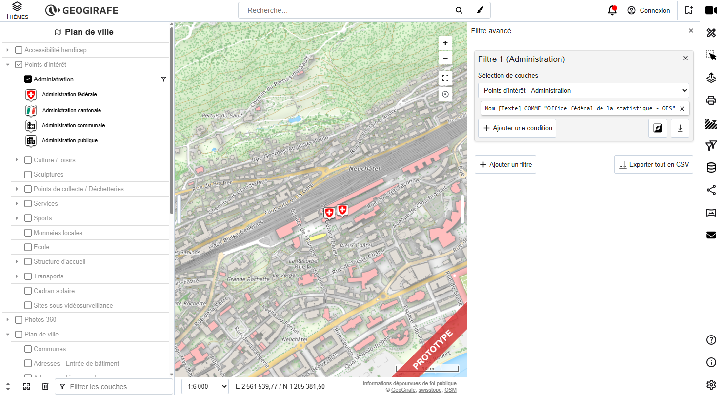
One of the biggest new features in GeoGirafe is the Advanced Filtering tool. It gives users much more control over the data displayed on the map, allowing them to build complex queries and combine multiple filtering conditions.
With advanced filtering, users can now:
- Combine multiple conditions using
ANDandORoperators. - Filter data based on geometry, using spatial relationships such as within, contains, and intersects.
- Filter by a list of values, with
INandNOT INoperators. - Invert a filter to display features that do not match the selected criteria.
- Choose from available attribute values provided by the layer.
- Apply filters directly to a layer and immediately update the map.
- Export filtered data to CSV, either for a single layer or for all filtered layers at once.
- Combine and nest conditions, making it possible to create more complex filters.
The advanced filter also works together with the existing layer filtering tools, making it easier to move between simple and more advanced ways of exploring your data.
Drawing and measuring are now more powerful
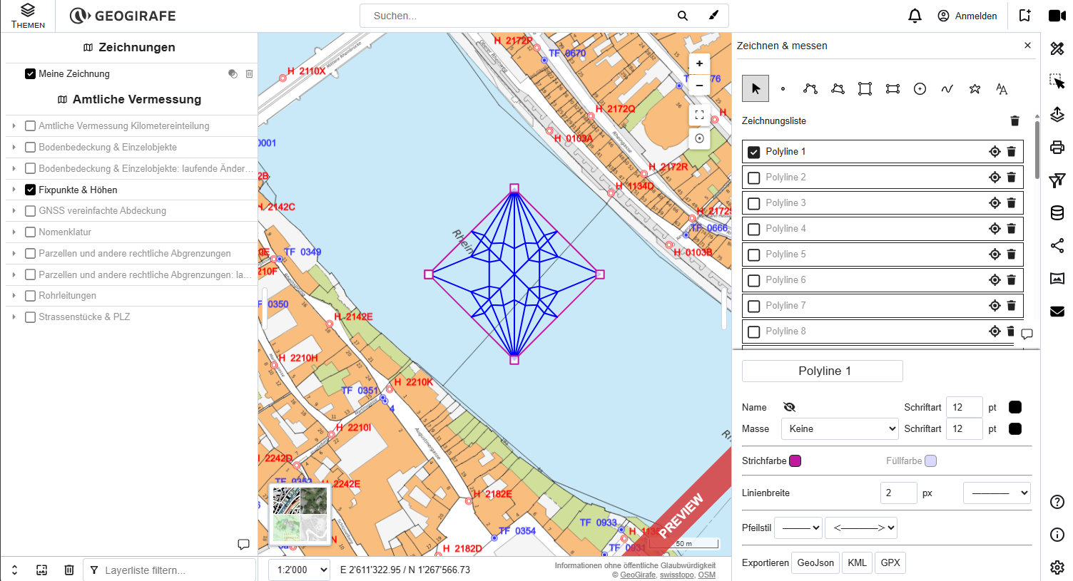
The biggest improvement in this area is the ability to load GeoJSON data directly into the viewer and then edit it using the drawing tool. Users can now easily customize their geometries by changing their colour, line width, and other visual properties.
Several other improvements have also been made to make drawing and measuring more intuitive and flexible:
- Text can now be added directly to the map.
- The layer containing drawn features can be removed.
- An issue affecting the export of circles has been fixed.
- The context menu is now disabled while drawing.
- Drawn features can be selected.
- Line width and colour options are automatically disabled when they are not applicable to the selected drawing type.
- Users can choose the level of detail displayed for measurements, such as length, perimeter, and area.
API improvements
Several new API capabilities make GeoGirafe easier to configure and integrate into different projects.
The viewer can now read information from text files and use this information to display titles and descriptions. This provides a simple way of managing application content externally, without necessarily having to modify the application itself.
Icon configuration has also been extended. Developers can now define the offset and size of icons, providing greater control over how map symbols are positioned and displayed.
These improvements make the API more flexible and facilitate the integration of GeoGirafe into different application contexts.
Expand search possibilities
The search functionality has been extended with a new geographic administrative search provider. This makes it possible to search for administrative geographical entities and provides users with another way of quickly finding a location within the map.
Making GeoGirafe easier to use
Several changes focus on making the interface more adaptable and intuitive.
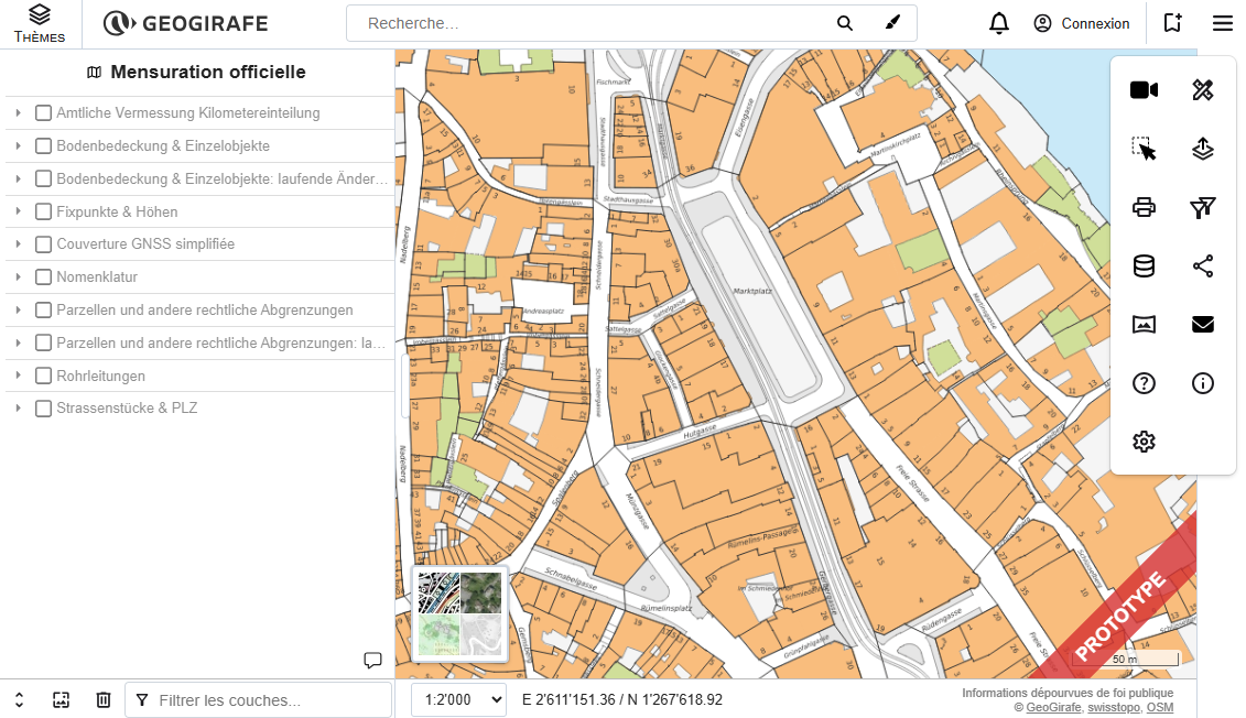
The button bar has been improved to better handle smaller screen sizes. This is particularly important for applications that need to work across a wide range of devices and screen resolutions.
Another area of improvement concerns highlighted features. Work has been carried out to find a better way of managing highlighted features, with the aim of making the relationship between user interactions and the corresponding map features clearer.
Keep exploring with GeoGirafe
This summer’s developments bring new possibilities to GeoGirafe, from more powerful tools for exploring and editing data to a more flexible search, improved user experience, and new API capabilities.
With these new features, GeoGirafe continues to evolve to make web mapping more intuitive, flexible, and accessible to everyone.
And this is just another step in the journey — there are still plenty of new territories to explore!